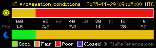
Propagation
(page
reloads every 12 minutes)
solmon_table
SolMon
|
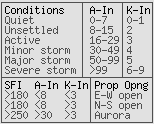
Geomagnetic Field A
|
Geomagnetic Field Kp |
Solar
X-ray
status |
Proton status |
Neutron
Event status |
| Local
Data: |
 |
 |
 |
 |
 |
| Last changed: |
2026-07-22 07:13:34Z
|
2026-07-22 07:13:34Z
|
2026-07-22 07:13:53Z
|
2026-07-22 07:14:43Z
|
2026-07-22 07:14:43Z
|
solmon_table
solmon_table
Zone
|
Current
|
Forecast
(6hr)
|
POLar
|
 |
: Polar") |
AURoral
|
 |
: Auroral") |
SUBauroral
|
 |
: Sub-Auroral") |
solmon_table_ca
SolMonCA
|
Current |
+6hr |
+24hr |
| POL / AUR / SUB
Data |
 |
 |
 |

|
iSWA -
Integrated Spaceweather Analysis system
:Product: Geophysical Alert Message wwv.txt
:Issued: 2026 Jul 22 0605 UTC
# Prepared by the US Dept. of Commerce, NOAA, Space Weather Prediction Center
#
#          Geophysical Alert Message
#
Solar-terrestrial indices for 21 July follow.
Solar flux 149 and estimated planetary A-index 14.
The estimated planetary K-index at 0600 UTC on 22 July was 3.33.

Space weather for the past 24 hours has been minor.
Radio blackouts reaching the R1 level occurred.

Space weather for the next 24 hours is predicted to be minor.
Geomagnetic storms reaching the G1 level are likely.
Radio blackouts reaching the R1 level are likely.
|
Magnetic
field reversal now
complete, the cycle has
completed and should now be heading towards Cycle 25!
Did you know: It would take about 1 million Earths to fill the Sun if it were a hollow ball.
|

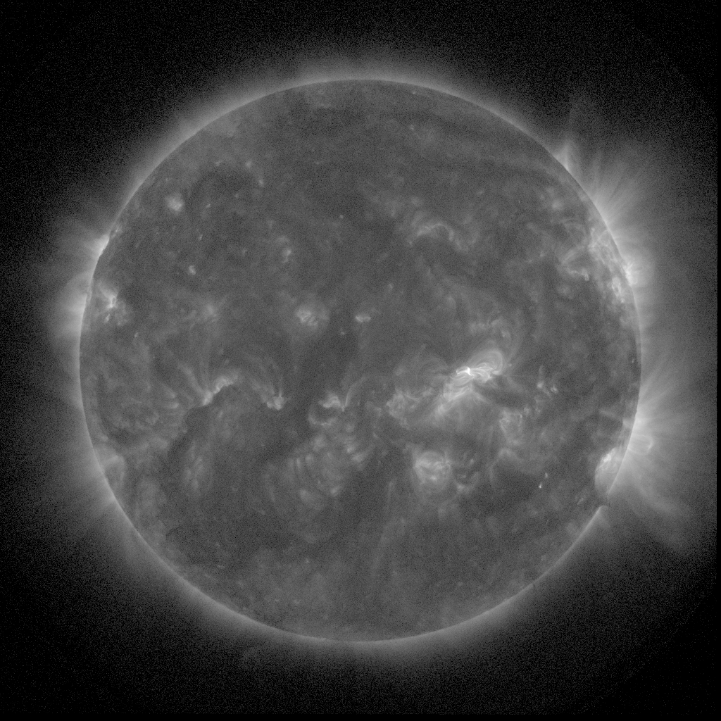
SUVI Extreme UV195Å
Fe XI,
1.5MK
|
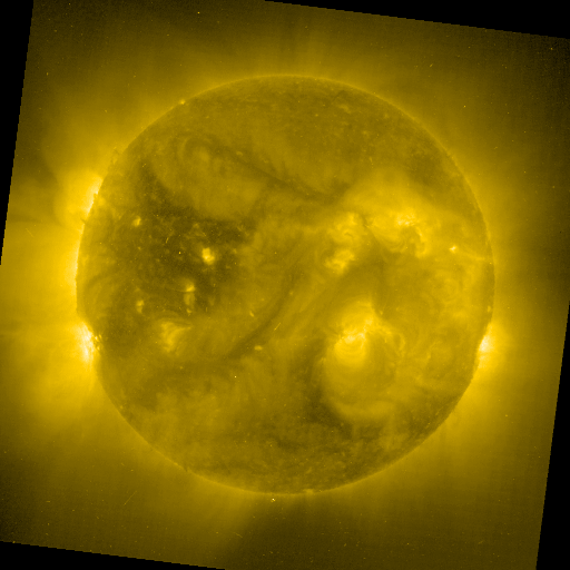
SUVI Extreme UV 284Å
Fe XV, 2MK
|

SUVI Summary
|
Nancay
0.9m
Not
Real Time
|
Nancay
1.8m
Not Real Time
|
|

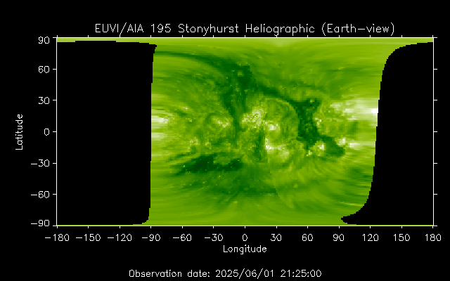
SUVI Extreme UV 171Å
Fe IX/X, 1MK
|
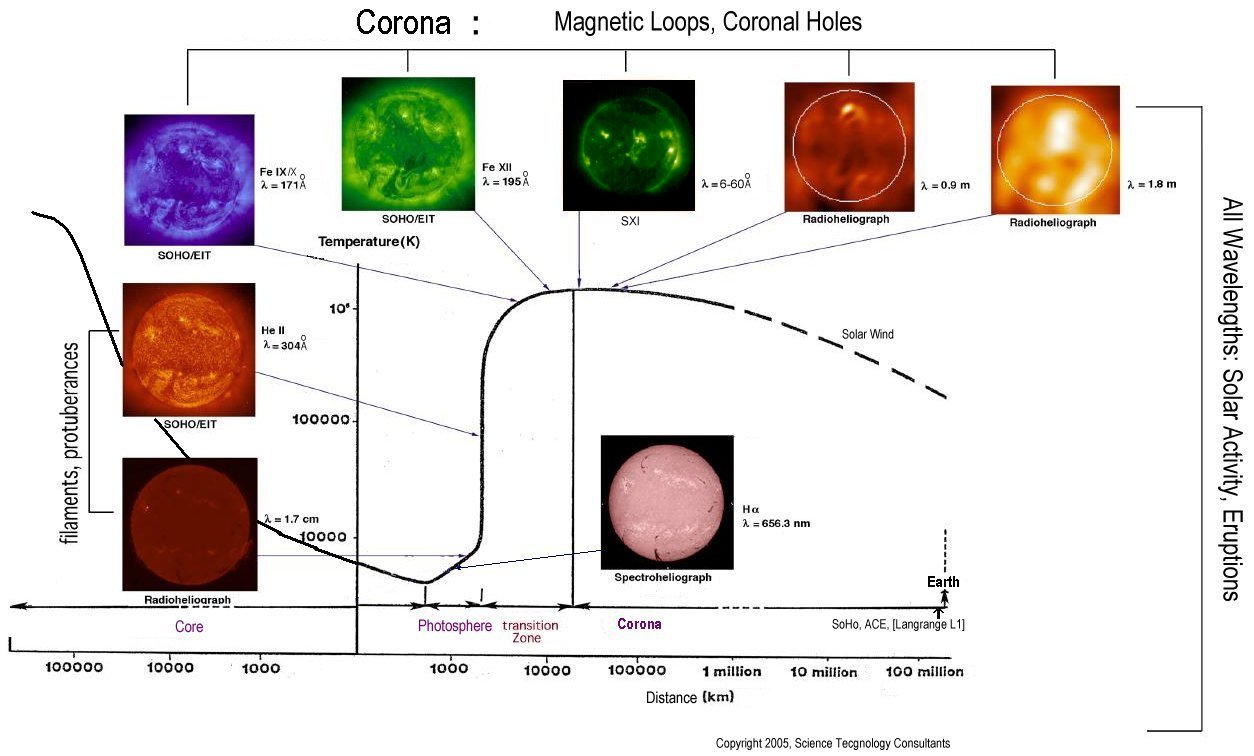
These real-time images follow
around the above graphic,
except that:
EIT 284Å is an
additional image
VHF/UHF images are not taken in
real-time
Handy
Electromagnetic Spectrum Calculator
|
|

EIT Extreme UV 304Å
He II, 20kK~100kK
|
|
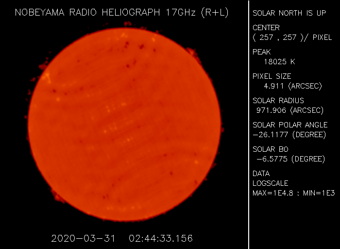
Nobeyama 1.7cm (17GHz)
|
|
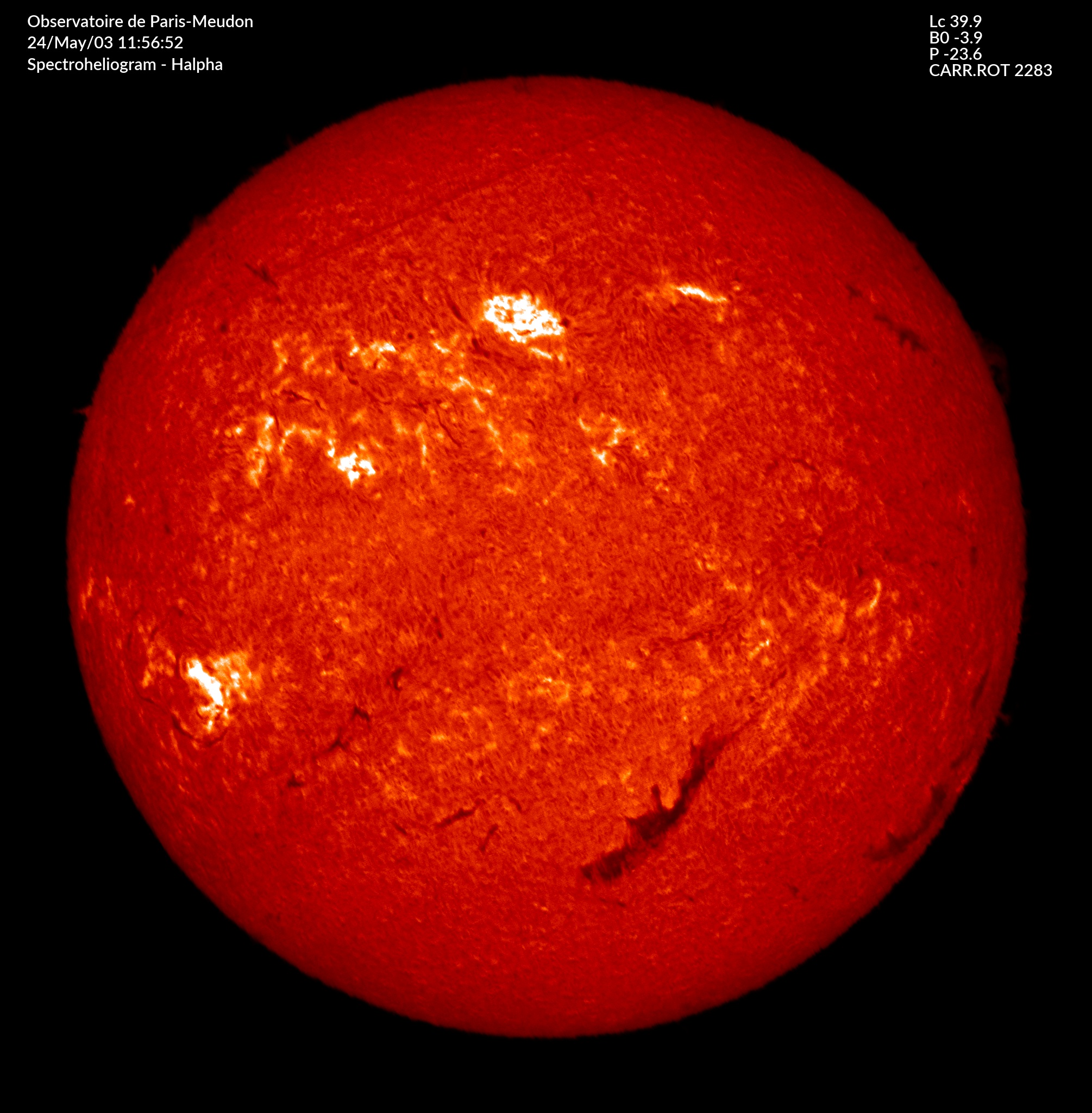
Meudon Hα
6563Å
|
 |
 |
| GOES-16
X-ray Flux (5 minutes) |
GOES-16
X-ray Flux (1 minute) |
 |
 |
| GOES-16
Electron Flux
(5 minutes) |
GOES-16
Proton Flux
(5 minutes) |
 |
 |
| K
Index
(3 hours) |
Combined
(1 minute) |
 |
 |
| GOES-16
Magnetometers (1 minute) |
Boulder
Magnetometer (1 minute) |

|
 |
'Kiel' magnetometer ~location 1 minute resolution
|
VLF 24kHz signal from NAA Cutler,Maine to
Louisville, Kentucky
|
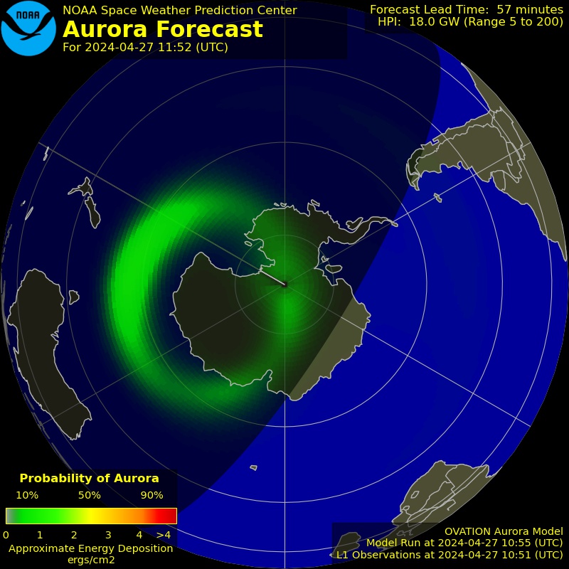
POES
data and OVATION
Aurora Prediction
 |
 |
North
Pole - 3 day
|
South
Pole - 3 day
|
 |
 |
North Pole forecast - 30 minutes
|
South Pole forecast - 30 minutes
|
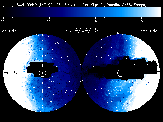
Both
SOHO
and ACE are
located at the L1 point between the Earth and Sun. This is about 1.5m
km from
Earth (or 932,000 miles).
From this vantage point Solar
wind data can be detected about 45 to 60
minutes
before reaching Earth.
 |
 |
| SDO
Magnetogram |
SDO
MDI - Sunspot indications |
How
magnetism varies cycle-to-cycle: NORTH=WHITE, SOUTH=BLACK.
[polarity is read from left to right]
Cycle 23 (May 1996): In the sun's northern
hemisphere, all spots were S-N. In the southern hemisphere, all spots
were N-S.
Cycle 24 (Jan 2008): Northern
sunspots are N-S while southern sunspots are S-N.
This reversal occurs each time one
cycle gives way to the next. It is called Hale's
Law.
 |
| SWAP EUV SoFAST
flare detection |

Data on
this page courtesy of: esa/SOHO,
NASA, Solar Terrestrial Dispatch,
Stanford University (Solar Oscillations Investigation group),
spaceweather.com, NW Research Associates, NOAA/SWPC (Space Weather
Prediction Center),
Lockheed Martin (Solar & Astrophysics Laboratory)
Raben Systems, Inc., n2yo.com, Deep Space Network and the hundreds of
ground
support team
personnel involved in these projects.


 when flying in")


